Services

More than a survey

Delivering Comprehensive Land Solutions Beyond Traditional Surveying for Precise Planning, Development, and Construction Success

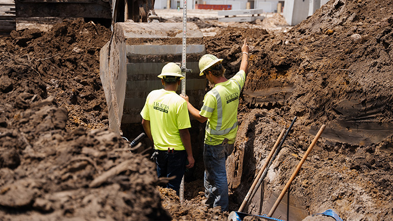
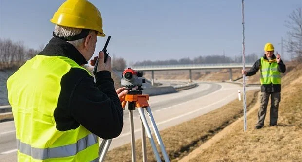
At Apollo Land Services, we go beyond traditional surveying to provide comprehensive land solutions tailored to your project’s success. Our expertise extends beyond measurements and mapping—we offer strategic insights, advanced technology, and industry best practices to support efficient decision-making. Whether it’s site analysis, risk assessment, or compliance guidance, we ensure every aspect of your land development process is backed by precision and reliability.

With a customer-centric approach, we work closely with engineers, architects, and developers to optimize land use and ensure smooth project execution. Our team utilizes cutting-edge tools, including GPS and drone technology, to enhance accuracy and efficiency. From pre-construction planning to final site assessments, Apollo Land Services is your trusted partner in transforming land data into actionable intelligence. Choose us for more than just a survey—experience expert-driven solutions that elevate your projects and streamline your development journey.

Services

Survey team is working with a theodolite and road construction plans.

LAND SURVEYING

Our expert Land Surveying services provide accurate boundary mapping, topographic surveys, and site assessments for residential, commercial, and infrastructure projects. Using advanced technology, we ensure precise measurements, legal compliance, and efficient land development, helping clients make informed decisions for construction, property transactions, and land use planning.

Female Surveyor measuring land with digital level

MEASURED BUILDINGS

Our Measured Buildings surveys provide precise architectural and structural data, including floor plans, elevations, and cross-sections. Using advanced laser scanning and surveying techniques, we deliver accurate measurements for renovations, refurbishments, and property assessments, ensuring detailed documentation for architects, engineers, and property developers.

Underground and Utilities

Our Underground and Utilities mapping services accurately locate underground pipes, cables, and drainage systems. Using advanced detection technologies, we help prevent costly excavation damages, enhance project safety, and ensure compliance with regulations. Our surveys provide essential data for construction, infrastructure development, and utility maintenance planning.

SITE ENGINEERING

Our Site Engineering services provide precise land assessments, grading, drainage planning, and foundation analysis to support construction and infrastructure projects. Using advanced surveying techniques, we ensure accurate site preparation, regulatory compliance, and efficient project execution, helping engineers, architects, and developers optimize land use and structural integrity.

MONITORING

Our Monitoring services track structural movement, environmental changes, and site stability over time. Using advanced surveying instruments, we detect shifts in buildings, land, and infrastructure, helping prevent potential risks. This ensures safety, regulatory compliance, and informed decision-making for construction, maintenance, and long-term project sustainability.

HYDROGRAPHICAL SURVEYS

Our Hydrographical Surveys provide precise mapping of water bodies, including depths, seabed features, and underwater structures. Using advanced sonar and GPS technology, we support marine construction, dredging, flood risk assessment, and environmental monitoring. These surveys ensure safe navigation, regulatory compliance, and efficient waterway and coastal development planning.

Engineer construction used drone take photo aerial view for inspection and survey at construction si

DRONE SURVEYING SERVICES

Our Drone Surveying Services provide high-resolution aerial mapping, topographic surveys, and site inspections with speed and precision. Using advanced drone technology, we capture accurate geospatial data for construction, land development, and environmental monitoring, ensuring cost-effective, efficient, and detailed analysis for informed decision-making and project planning.

RAAC SERVICES

Our RAAC (Reinforced Autoclaved Aerated Concrete) Services specialize in assessing, inspecting, and monitoring RAAC structures for safety and integrity. We identify potential weaknesses, provide detailed reports, and recommend necessary remediation. Our expert evaluations help property owners, engineers, and developers ensure compliance, minimize risks, and maintain structural stability.

REVIT MODELS

Our Revit Modeling Services provide accurate 3D Building Information Modeling (BIM) for architectural, structural, and MEP designs. We create detailed, data-rich models that enhance project visualization, streamline collaboration, and improve efficiency in construction planning, renovations, and facility management, ensuring precise design execution and seamless coordination across teams.

DIGITAL TWIN

Our Digital Twin services create virtual replicas of physical assets, enabling real-time monitoring, analysis, and optimization. Using advanced 3D modeling and data integration, we enhance decision-making for construction, infrastructure, and facility management, ensuring improved efficiency, predictive maintenance, and seamless project lifecycle management.

Survey team is working with a theodolite and road construction plans.

LAND SURVEYING

Our expert Land Surveying services provide accurate boundary mapping, topographic surveys, and site assessments for residential, commercial, and infrastructure projects. Using advanced technology, we ensure precise measurements, legal compliance, and efficient land development, helping clients make informed decisions for construction, property transactions, and land use planning.

MEASURED BUILDINGS

Our Measured Buildings surveys provide precise architectural and structural data, including floor plans, elevations, and cross-sections. Using advanced laser scanning and surveying techniques, we deliver accurate measurements for renovations, refurbishments, and property assessments, ensuring detailed documentation for architects, engineers, and property developers.

Female Surveyor measuring land with digital level

Underground and Utilities

Our Underground and Utilities mapping services accurately locate underground pipes, cables, and drainage systems. Using advanced detection technologies, we help prevent costly excavation damages, enhance project safety, and ensure compliance with regulations. Our surveys provide essential data for construction, infrastructure development, and utility maintenance planning.

SITE ENGINEERING

Our Site Engineering services provide precise land assessments, grading, drainage planning, and foundation analysis to support construction and infrastructure projects. Using advanced surveying techniques, we ensure accurate site preparation, regulatory compliance, and efficient project execution, helping engineers, architects, and developers optimize land use and structural integrity.

MONITORING

Our Monitoring services track structural movement, environmental changes, and site stability over time. Using advanced surveying instruments, we detect shifts in buildings, land, and infrastructure, helping prevent potential risks. This ensures safety, regulatory compliance, and informed decision-making for construction, maintenance, and long-term project sustainability.

HYDROGRAPHICAL SURVEYS

Our Hydrographical Surveys provide precise mapping of water bodies, including depths, seabed features, and underwater structures. Using advanced sonar and GPS technology, we support marine construction, dredging, flood risk assessment, and environmental monitoring. These surveys ensure safe navigation, regulatory compliance, and efficient waterway and coastal development planning.

Engineer construction used drone take photo aerial view for inspection and survey at construction si

DRONE SURVEYING SERVICES

Our Drone Surveying Services provide high-resolution aerial mapping, topographic surveys, and site inspections with speed and precision. Using advanced drone technology, we capture accurate geospatial data for construction, land development, and environmental monitoring, ensuring cost-effective, efficient, and detailed analysis for informed decision-making and project planning.

HYDROGRAPHICAL SURVEYS

Our Hydrographical Surveys provide precise mapping of water bodies, including depths, seabed features, and underwater structures. Using advanced sonar and GPS technology, we support marine construction, dredging, flood risk assessment, and environmental monitoring. These surveys ensure safe navigation, regulatory compliance, and efficient waterway and coastal development planning.

RAAC SERVICES

Our RAAC (Reinforced Autoclaved Aerated Concrete) Services specialize in assessing, inspecting, and monitoring RAAC structures for safety and integrity. We identify potential weaknesses, provide detailed reports, and recommend necessary remediation. Our expert evaluations help property owners, engineers, and developers ensure compliance, minimize risks, and maintain structural stability.

REVIT MODELS

Our Revit Modeling Services provide accurate 3D Building Information Modeling (BIM) for architectural, structural, and MEP designs. We create detailed, data-rich models that enhance project visualization, streamline collaboration, and improve efficiency in construction planning, renovations, and facility management, ensuring precise design execution and seamless coordination across teams.

DIGITAL TWIN

Our Digital Twin services create virtual replicas of physical assets, enabling real-time monitoring, analysis, and optimization. Using advanced 3D modeling and data integration, we enhance decision-making for construction, infrastructure, and facility management, ensuring improved efficiency, predictive maintenance, and seamless project lifecycle management.

Surveying equipment to infrastructure construction project